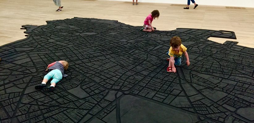
Designing Cities Orientation Week, 19/21 September 2016. Introduction and Project@London on ‘Living Cities‘ @TateModern, ways to discovering London! Picture: kids playing on a large floor-based rubber map of the city of Beirut, ‘Beirut Caoutchouc‘, Marwan Rechmaoui, 2004-8 © Tate, London [2016]. The map of the city ‘is embossed with roads and highways represented in precise detail. It is segmented into sixty individual pieces following the division of neighbourhoods in the city, yet when it is exhibited the map appears singular and complete. Consequently Rechmaoui’s installation examines the physical and social formation that make up one of the world’s most conflicted cities. However, other than the demarcations of roads and neighbourhoods, landmarks or specific points of identification – including the green line that divided Christian and Muslim communities during the Lebanese civil war (1975–90) – are absent, mapping a terrain empty of the political and religious divisions that have characterised the city’s recent history. The artist’s use of rubber stresses the city’s resilience, despite human and natural threat, while it also provides a durable surface for the viewer to walk across, initiating a personal encounter with both the artwork and the city it represents’. A way to reflect, through art, on the physical and social dimensions of space.
- POST-COVID CITIES: A DIALOGUE WITH PRACTICE - October 9, 2020
- INDUSTRY PROJECT - June 13, 2020
- DESIGNING CITIES ON-LINE - April 6, 2020
